
I thought to myself before leaving "if I'm going to make a film about these guys, then I need to immerse myself in their world...". Along with getting video footage as a third person, That was the point of going. I really need to watch what I ask for...
Unimak Island, the first island in the Aleutian chain, home of several large and active volcanoes, notoriously windy and wet and all that stuff. For the end of Erin and Hig's trip it was "to go as far as the bears can go" which was the southwest tip of the island. From that point at Scotch cap, its over 12 miles of open ocean to the next island and out of scope of the packraft.
leaving False Pass

Beach hiking in the mist

We traveled about 190 miles in 11 days mostly along the island's coast, walking the black volcanic sand beaches and following bear trails through the tundra over rocky headlands. We saw Orcas, sea lions, caribou, foxes, lots and lots of huge wolf tracks, countless eagles and 14 Brown bears, more on that in a bit.
on the bear trails

On our 4th night we were finishing dinner at the cooking fire after a long 20 mile day, it was close to midnight and starting to rain. Our shelter was just up in the tundra from where were were cooking on the beach, as I approached I senced something wrong, the mid wasnt there any more... a few seconds later I see a big Grizzly bound away from the remains of our camp a short distance to a bluff. It was a tense moment, it seemed to be a habituated bear, or a very bold one at least. I yelled down to Erin and Hig and once we were grouped up the bear continued to back away into the rolling tundra. We then assessed the damage:
The toll was staggering, our (very important!)1 lb silnylon mid was totally torn up on all 4 sides, all three thermarests were torn up, one in several pieces, he put a gaping hole in one raft, sliced and diced two try bags, then stomped and cracked a paddle blade and literally chewed on Erin and hig's ID and credit cards. He also got some food of course, some of it totally gone.
After kinda standing in shock at the carnage the reality set in - we are about 80 miles and 4 days from anything with no shelter from the relentless wet weather. We needed the shelter back.
Luckily the three of us know our way around a needle and thread so we worked around the clock in shifts through the night and late into afternoon the next day sewing up the shelter with dental floss. Hig took the first watch in a cold rain sewing by headlamp next to the fire, Erin and I tried to get some fitfull sleep under our rafts. I woke up cold and wet around 6:00 am, Hig was literally passing out mid-stitch and it was my turn, Hig made excellent progress in the night, he moved the fire and had the shelter pitched over the previous fire spot so we could get some warmth from the hot sand. My down sleeping bag was soaked and I generally felt naucious in the morning hours as my body tried to shake the wet cold and the poor night's sleep. Stitch by stich the shelter came together, 24 feet of hand stitching later. We mostly dried my down bag using hot rocks buried in warm sand as a heat source... it stopped raining, things were looking up

With the shelter repaired we started work on the packraft, thermarests and Hig & Erin's sleeping quilt. All said and done most of the critical gear was repaired and usable again except for the one totally destroyed thermarest, by 7:00pm that night, we were hiking away from the camp and the rough night.
Our food supply was low however, we over analyzed it countless times, but in the end we simply came to the conclusion that a hasty packing job in False Pass was to blame and many , many calories that we needed were left behind packed in a duffel. We startred on "first hunger" rations, which quite quickly turned to basically starvation rations... I had a hard time with it. It was hard to keep warm in the wet conditions without the calories... onward we went around the southern tip of the island.
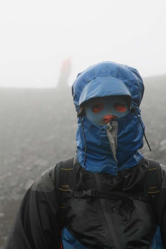
Erin in full conditions

We packrafted around Scotch cap after a breif celebration of Erin and Hig's turnaround point, just another sea stack on a black beach... we paddeled the open ocean getting driven by wind and rain around several points, covering ground fast but getting soaked to the bone in the process... finally it was obvious that the wind was getting beyond the point of being safe and we were all quite spread out. Erin and Hig got ashore on one beach while I got blown further down the coast, as I watched a brown bear wander in their direction along the beach. Regrouped we started hiking fast inland, totally soaked, layers of fleece and primaloft trying to keep the body heat in. We marched northward now with the wind across barren volcanic cinder plains... when we finally saw it.. A massive world war II radar station on the horizion. It looked like a small city from a distance and we knew that we could find shelter from the storm there.

We arrived at the Dismal fortress and got the needed shelter from the wind and rain. The compound however was straight out of a sci-fi horror post-apocoliptic nightmare movie, complete with erie shreaking sounds, broken glass and rusted gnarled metal on each step, dripping roofs, gnarled and rusting machinery, dark and empty computer rooms full of thrashed wires and panels. We half expected to find zombies or aliens here, it was that freaky... With our one headlamp Hig explored the 5 story living quarters of the compound and we eventually set a sort of camp in the stairwell and made a fire at the top to try to dry out. the Wind updraft was increadible and the fire literally jettet straight up to the shaft... I bivied in a less drafy spot in a dark room while the thrashings and erie shreiking sounds echoed relentlessly. With no water for the night or morning, we quickly left in the morning back into the mist, glad to be leaving the dismal fortress... like a fussy dream it was quite an experience:

For two days we circled the islands southern volcanoes cutting back inland crossing expansive cinder plans and glacier fed rivers. We waited out the weather one day until 2pm until we finally needed to make progress in light of our very limited food situation. We hiked into Fisher Caldera, a massive volcanic caldera many many miles in diameter where we found a bit of shelter from the blowing wind and rain. I was in survival mode at this point and at one of my lowest points of the trip, my torn thermarest piece stuffed under my rain jacket to add a bit of insulation. We packrafted across the large lake in the caldera and soaking once again, packed up and started hiking further, and further, it cleared a bit,, drying out a tad, further still until midnight.
lakes of Fisher Caldera

From the Caldera it was about 10 miles back to the coast which we covered the next morning. Getting to the coast was a big deal, because it meant there would be driftwood and a fire, and a meal, and a new batch of spatial rations.
back on the beach

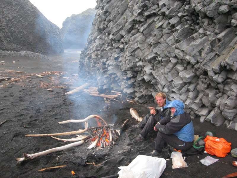
food+fire=happy

Cooking on fires was a new thing for me on this trip and I learned alot just by going through the motions. Both Hig and Erin are fire starting Ninja's as they've relied on them for every meal over the past year. Hig can ignite things just by looking at them:

Home stretch to False pass, we backtracked along the beach for about 20 miles, then shortcutted inland, crossing marhes, more rivers, cinderplain and tundra.
The food intake bottoming out, taking me to new places...
surrounded by empty ziplock's...how far to False pass?


The weather cooperated the last two days which really made for higher spirits, aside from the lack of calories it was some of the best and most beautiful traveling you could ask for. We popped back to the coast with only 3 miles of coast remaining and finished the trip. For me it was a challenging 11 days, a bit out of my element, but for Erin and Hig it was just a tough leg out of the past 4000 miles and the end of the line for them. With smiles they boarded the ferry back to Homer being the first motorized vehicle they've used for over a year.
See Erin and Hig's blog post here
My video efforts were cut short as my camera decided to take a dive after the bear thrashing. It was really quite fitting that everything got thrashed on this trip, but it sucked carrying the extra dead weight that I could not eat!
5 comments:
Damn.
You've had a good run this month. Crazy Alaskans.
Ho. Lee. Crap.
Another epic starvation vision quest? I think there are some monks in Tibet who might like to recruit you.
Still jealous, though. Congrats to Erin and Hig on completing their trip.
Amazing pictures - can't wait to hear the story in person, although I'm not sure if I'm tough enough to be your friend anymore. Way to stick it out and turn it into a good experience - gotta love retrospective fun :-)
impressive trip. i lived at cape sarichef for one year and hiked quite a bit in the areas you mention. i think it is just about the toughest conditions a backpacker could face. if the wet winds, whiteouts, and abundant bears don't wipe you out Unimak Island is one of the most wild places in America.
Did you by chance take any pics of my old Coast Guard station at Cape Sarichef or Scotch Cap?
Cheers,
Bobby
Apple Valley, MN
bobbywertis@msn.com
yo fellow suffer lovers
check this little trip out:
kite-alaska.com/html/unimak.html
unimak is a special place for special people!!
gimme.
wyomingsurfer@hotmail
Post a Comment